1
/
of
1
Rand McNally
Rand Mcnally Easy To Read: Louisiana State Map
Rand Mcnally Easy To Read: Louisiana State Map
ISBN-13: 9780528025754
Regular price
$12.61
Regular price
Sale price
$12.61
Unit price
/
per
Couldn't load pickup availability
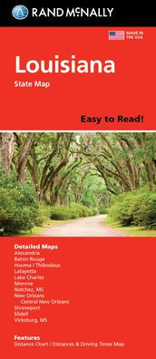
Rand McNally's Easy To Read State Folded Map is a must-have for anyone traveling in and around Louisiana, offering unbeatable accuracy and reliability at a great price. Our trusted cartography shows all Interstate, U.S., state, and county highways, along with clearly indicated parks, points of interest, airports, county boundaries, and streets. The easy-to-use legend and detailed index make for quick and easy location of destinations. You'll see why Rand McNally folded maps have been the trusted standard for years. - Regularly updated, full-color maps. - 29% larger map with a bigger type size than the Rand McNally Folded Map. - Clearly labeled Interstate, U.S., state, and county highways. - Indications of parks, points of interest, airports, county boundaries, and more. - Mileage and driving times map. - Detailed index. - Convenient folded size. Coverage Area: Detailed maps of: Alexandria, Baton Rouge, Lafayette, Lake Charles, Monroe, New Orleans & Vicinity, Downtown New Orleans, Shreveport. Product Details: Dimensions (unfolded): 28 x 40.
- | Author: Rand McNally
- | Publisher: Rand Mcnally
- | Publication Date: May 16, 2022
- | Number of Pages: 1 pages
- | Language: English
- | Binding: Map
- | ISBN-10: 0528025759
- | ISBN-13: 9780528025754
Share