1
/
of
1
Rand McNally
Rand Mcnally Easy To Read: Delaware, Maryland State Map
Rand Mcnally Easy To Read: Delaware, Maryland State Map
ISBN-13: 9780528025686
Regular price
$12.63
Regular price
Sale price
$12.63
Unit price
/
per
Couldn't load pickup availability
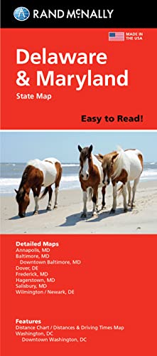
Rand McNally's folded map for Delaware and Maryland is a must-have for anyone traveling in or through these states, offering unbeatable accuracy and reliability at a great price. Our trusted cartography shows all Interstate, U.S., state, and county highways and much more. - Points of interest. - State Park chart. - State mileage chart. - Driving times map. - On-the-road toolbox. - Visitor center information. - Climate data. - State facts & symbols. - Easy-to-use legend. Coverage Area Detailed maps include: Dover, DE; Wilmington, DE; Annapolis, MD; Baltimore, MD; Baltimore Downtown, MD; Frederick, MD; Hagerstown, MD; Washington, D.C., Washington, D.C. Downtown. Product Details: Measures 9.0 x 4.125 and folds out to 25.5 x 36.75.
- | Author: Rand McNally
- | Publisher: Rand McNally
- | Publication Date: May 16, 2022
- | Number of Pages: Not Available pages
- | Language: English
- | Binding: Map
- | ISBN-10: 0528025686
- | ISBN-13: 9780528025686
Share