Rand McNally
Rand Mcnally Folded Map: Denver Regional Map - 9780528025419
Rand Mcnally Folded Map: Denver Regional Map - 9780528025419
ISBN-13: 9780528025419
Precio habitual
$13.48
Precio habitual
Precio de oferta
$13.48
Precio unitario
/
por
Los gastos de envío se calculan en la pantalla de pago.
No se pudo cargar la disponibilidad de retiro
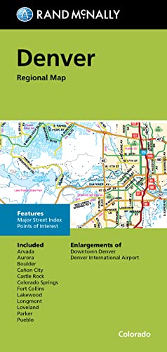
Rand McNally's folded map for Denver is a must-have for anyone traveling in and around this part of Colorado, offering unbeatable accuracy and reliability at a great price. Our trusted cartography shows all Interstate, U.S., state, and county highways, along with clearly indicated parks, points of interest, airports, county boundaries, and streets. The easy-to-use legend and detailed index make for quick and easy location of destinations. You'll see why Rand McNally folded maps have been the trusted standard for years. - Regularly updated. - Full-color maps. - Clearly labeled Interstate, U.S., state, and county highways. - Indications of parks, points of interest, airports, county boundaries, downtown & vicinity maps. - Easy-to-use legend. - Detailed & full street index. - Enlargements of Denver Downtown and Denver International Airport. - Convenient folded size. Coverage Area Communities Included: Arvada, Aurora, Boulder, Canon City, Castle Rock, Colorado Springs, Fort Collins, Lakewood, Longmont, Loveland, Parker, Pueblo. Product Details: Measures 9.5' x 4' and folds out to 40' x 28'.
- | Author: Rand McNally
- | Publisher: Rand Mcnally
- | Publication Date: Oct 14, 2022
- | Number of Pages: 1 pages
- | Language: English
- | Binding: Map
- | ISBN-10: 0528025414
- | ISBN-13: 9780528025419
Share